Custom Maps
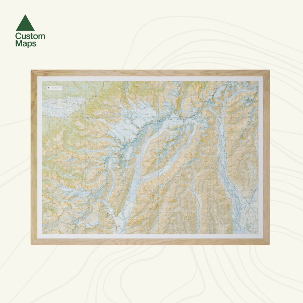
Aoraki Mount Cook National Park Wall Map
Aoraki Mount Cook National Park Wall Map
Regular price
$145.00 NZD
Regular price
Sale price
$145.00 NZD
Taxes included.
Shipping calculated at checkout.
- Ships from NZ
- Hundreds of Happy Customers
- The Perfect Gift
Quantity
Couldn't load pickup availability
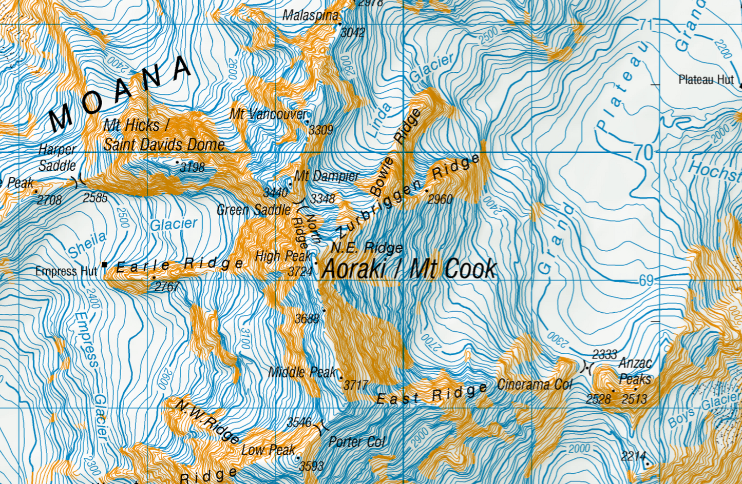
This giant topographic map of Aoraki / Mount Cook National Park makes a stunning statement piece for any room. Produced using Topo50 data, this map stretches from the Burster Range in the north, to the Godley in the east, and Mount Cook Airport in the south.
What Our Customers Love
- Made to last – Professionally printed on premium, high-quality, water-resistant, tear-proof paper with a borderless edge for an exquisite, premium finish.
- Any size – Choose the size that suits you, from A2 to A0+.
- The perfect gift – Ideal for housewarmings, weddings, anniversaries, or birthdays.
- Delivered nationwide – Shipped in reinforced, tracked packaging to ensure your map arrives in perfect condition.
- Ready to frame – Sold unframed. Pair your map with one of our Wooden Map Frames, so it’s ready to hang when it arrives, or see here for more framing information and frame options.
- NZ owned & operated – Designed and printed in Queenstown with care.
Size Options
- A0 (84.1 × 118.9 cm) – Recommended. This map was designed for A0 printing, giving optimal detail and resolution.
- A1 (59.4 × 84.1 cm) – A more compact print. Some smaller text may be harder to read.
- A2 (42.0 × 59.4 cm) – The most compact option. Significant detail will be lost, and some text may be illegible.
Customise Your Map
Looking for something different? We offer custom versions of any map – just contact us for more information.
Aoraki Mount Cook National Park Wall Map
$145.00
Size