Custom Maps
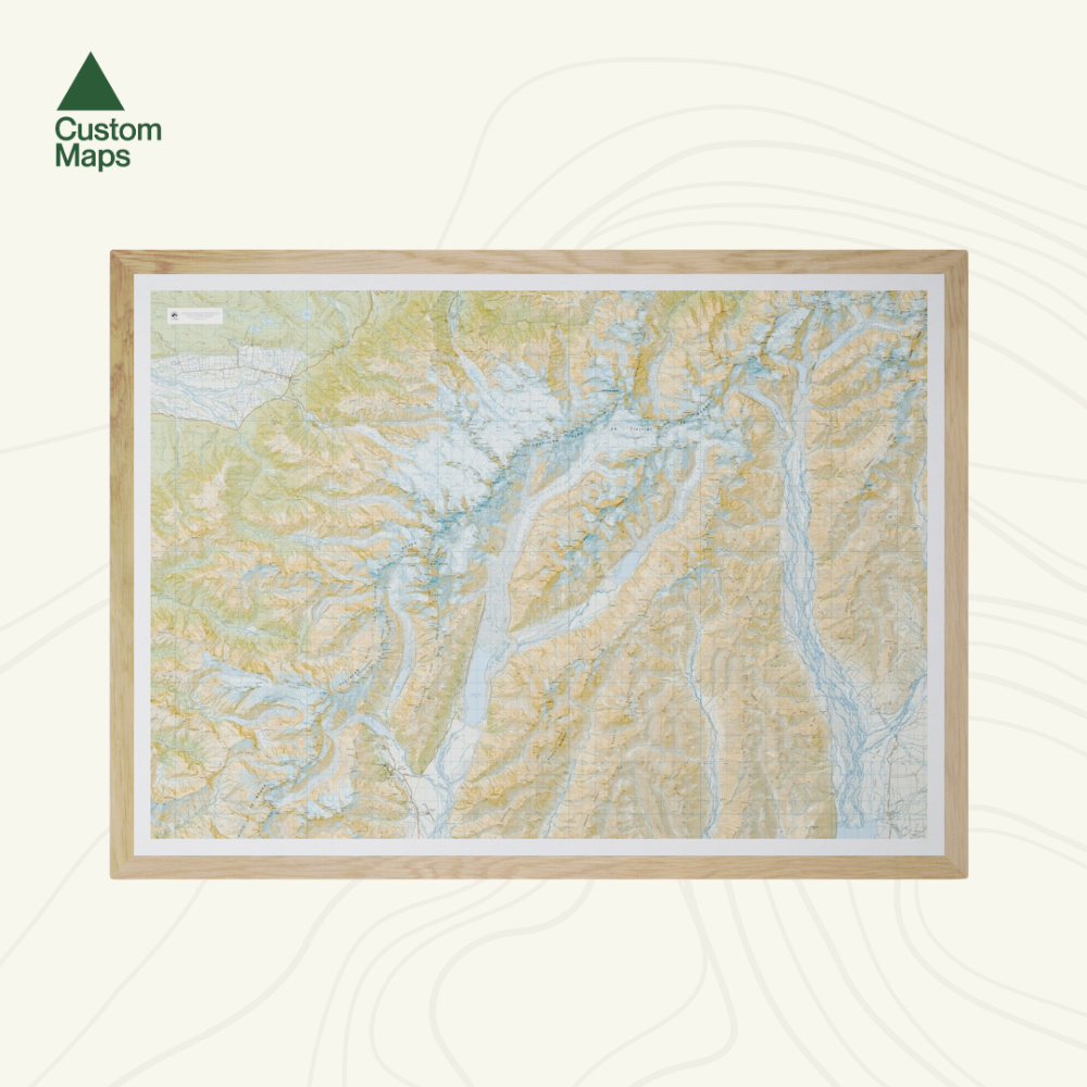
Aoraki Mount Cook National Park Wall Map
Aoraki Mount Cook National Park Wall Map
- Ships from NZ
- Hundreds of Happy Customers
- The Perfect Gift
Couldn't load pickup availability
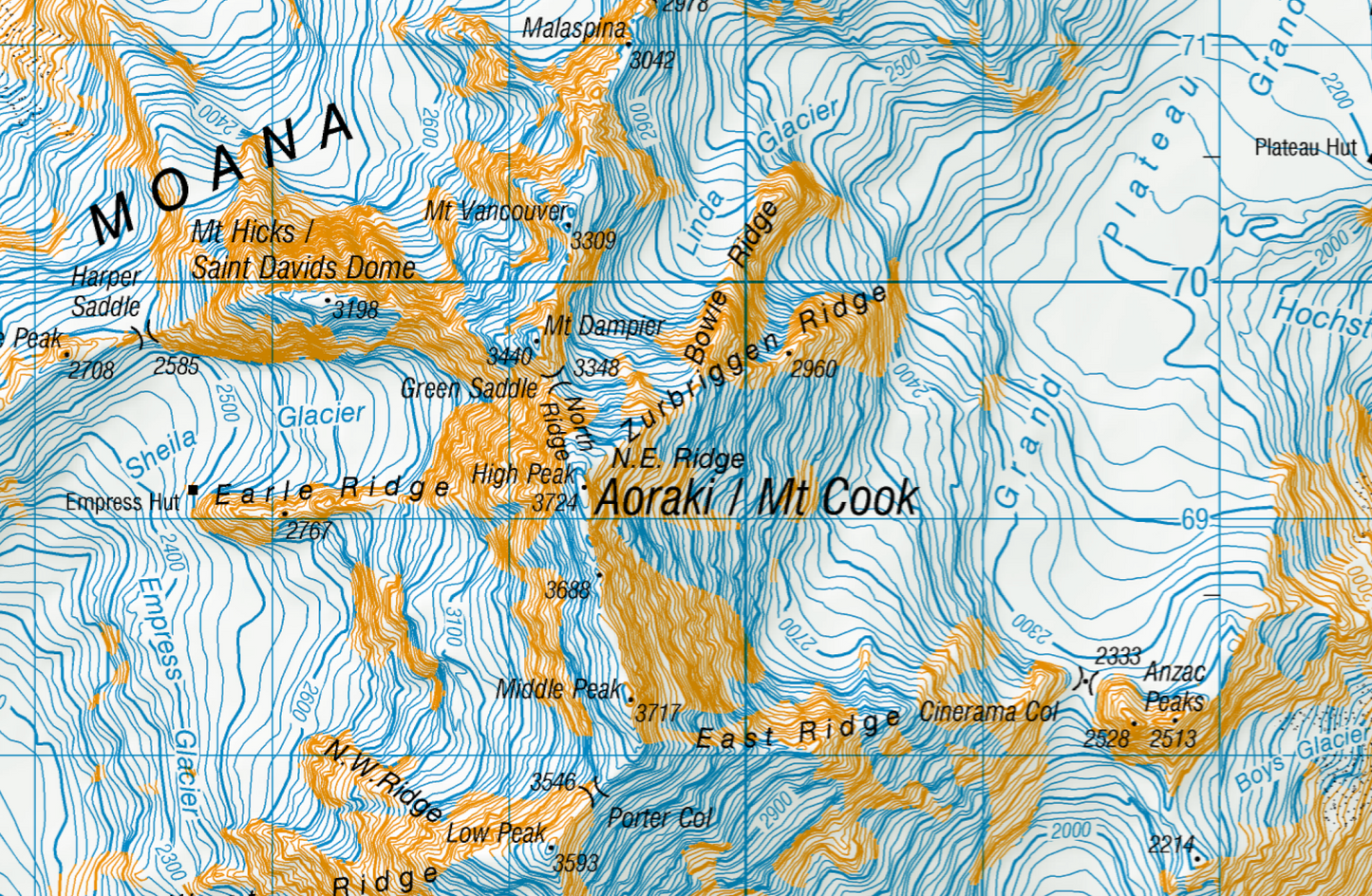
New Zealand's highest peak commands the room. This large-format topographic wall map of Aoraki Mount Cook National Park captures every glacier, ridge, and valley in precise detail, drawn from LINZ Topo50 data - the same source used by alpine guides and search and rescue teams.
Professionally printed on heavyweight, tearproof, water-resistant paper, with a borderless edge, this Aoraki topo map delivers rich colour and crisp detail. A bold statement piece for home, office, or bach.
Sold unframed. Pair your map with one of our Wooden Map Frames, so it’s ready to hang when it arrives, or see here for more framing information and frame options.
Size Options:
- A0 (84.1 × 118.9 cm) – Recommended. This map was designed for A0 printing, giving optimal detail and resolution.
- A1 (59.4 × 84.1 cm) – A more compact print. Some smaller text may be harder to read.
- A2 (42.0 × 59.4 cm) – The most compact option. Significant detail will be lost, and some text may be illegible.
Aoraki Mount Cook National Park Wall Map
$145.00
Size