


Custom Maps
Giant South Island Wall Map
Giant South Island Wall Map
- Ships from NZ
- Hundreds of Happy Customers
- The Perfect Gift
Couldn't load pickup availability
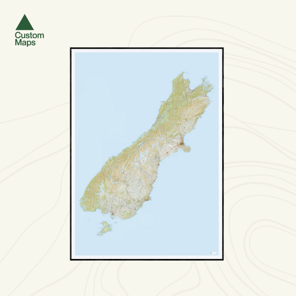
This giant topographic map of New Zealand's South Island is one of our most popular maps - and one of our favourites. Designed as a striking wall piece, it's built for impact from across the room: the kind of map that stops people in their tracks and sparks conversation.
Covering the full length of the South Island - Golden Bay in the north to Bluff and Stewart Island in the south - it showcases the extraordinary geography of Te Waipounamu in a single, spectacular view.
A note on scale: We've used compressed Topo250 data to fit the entire South Island onto a single A0 print. This means most place names are not legible up close — this is a wall art piece designed to be appreciated from a distance, not a reference map for reading detail. Major place names are clear but finer text is not. See the close-up photos for an example. If you need a map for detailed study, our regional maps will serve you better.
Professionally printed on high-quality, heavy-duty, water-resistant, tear-proof paper with a borderless edge. Sold unframed so you can choose the perfect frame for your space - see our framing options here.


