Custom Maps
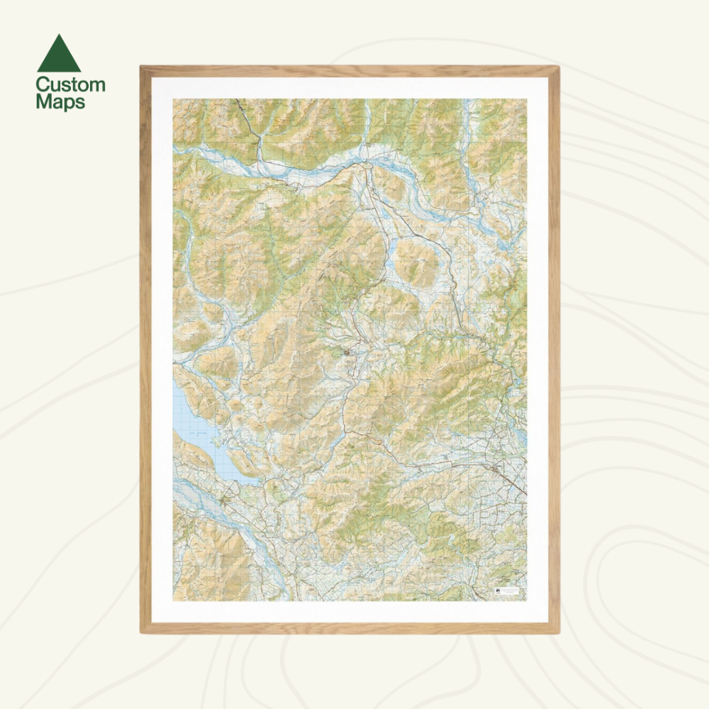
Castle Hill Wall Map
Castle Hill Wall Map
Regular price
$180.00 NZD
Regular price
Sale price
$180.00 NZD
Taxes included.
Shipping calculated at checkout.
- Ships from NZ
- Hundreds of Happy Customers
- The Perfect Gift
Quantity
Couldn't load pickup availability
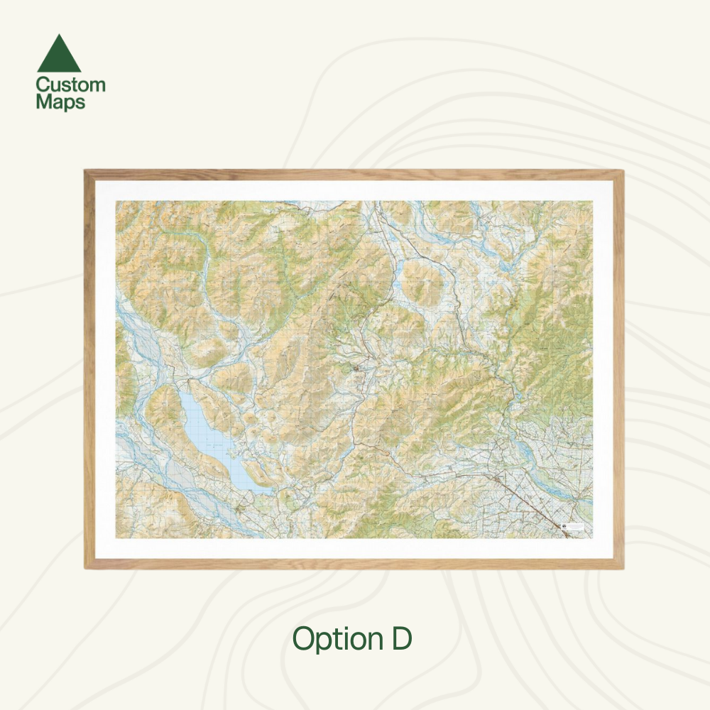
This giant topographic map of Castle Hill Village and the surrounding area makes a stunning statement piece for any room.
Professionally colour printed on high-quality, heavy-duty, water-resistant, tear-proof paper with a borderless edge.
Produced using Topo50 data, several variations of this map are available:
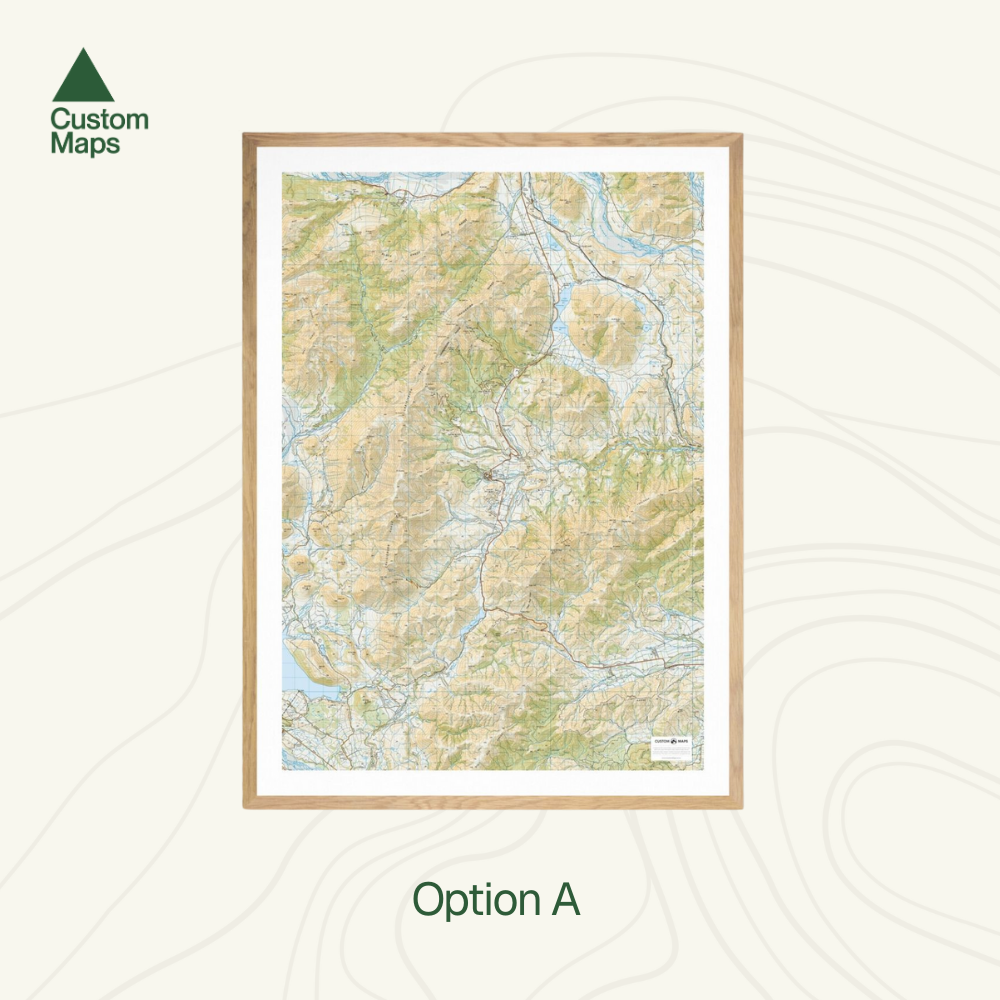
- Option A: Portrait, A1. Option A is a compact, portrait map, focused on Castle Hill village and the immediate surrounds. It is printed at a 1:50,000 scale on A1 paper (59.4 x 84.1cm).
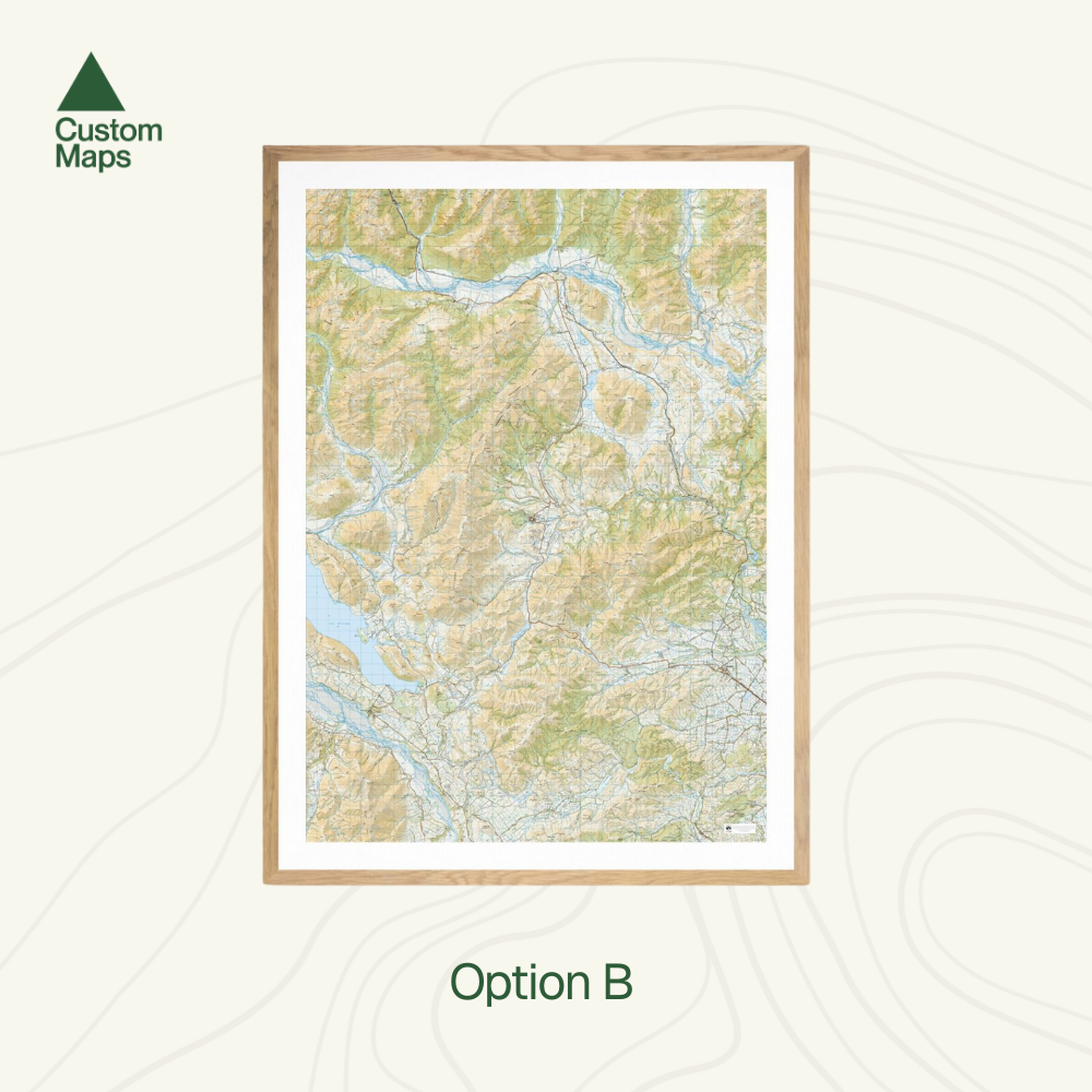
- Option B: Portrait, A0. Option B gives a view of the wider area. It stretches from Lake Coleridge in the west to the Poulter River in the east, and from Crow Valley in the north to South Malvern in the south. It is a larger map, printed at a 1:50,000 scale on A0 paper (84.1 x 118.9cm).
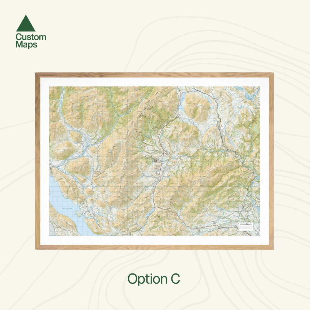
- Option C: Landscape, A1. Option C is a compact, landscape map, focused on Castle Hill village and the immediate surrounds. It is printed at a 1:50,000 scale on A1 paper (59.4 x 84.1cm).
- Option D: Landscape, A0. Option D gives a view of the wider area. It stretches from Lake Coleridge in the west to the Oxford Forest in the east, and from The Black Range in the north to Lake Lydon in the south. It is a larger map, printed at a 1:50,000 scale on A0 paper (84.1 x 118.9cm).
Variations are available on these maps, or any other custom topo map - please contact us.
Sold unframed. Pair your map with one of our Wooden Map Frames, so it's ready to hang when it arrives, or see here for more framing information and frame options.
Castle Hill Wall Map
$180.00
Option