Custom Maps
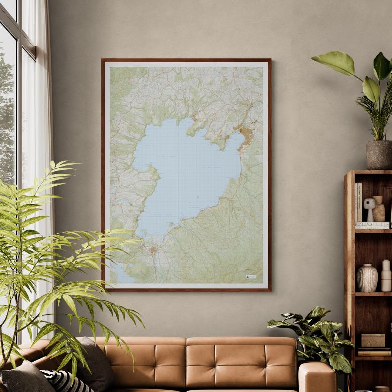
Lake Taupō Wall Map
Lake Taupō Wall Map
- Ships from NZ
- Hundreds of Happy Customers
- The Perfect Gift
Couldn't load pickup availability
This giant topo map of Lake Taupō makes a stunning wall piece and the perfect gift or adventure planning tool.
Focused on New Zealand's largest lake, this map also includes the surrounding geothermal wonders, forests, mountain peaks and townships of Taupō, Kinloch, Tūrangi, Motuoapa & Kuratau.
Produced using Topo50 data, this map is professionally colour printed on high-quality, heavy-duty, water-resistant, tear-proof paper with a borderless edge.
Print Options:
1. Classic - Our original print, on heavy-duty, water-resistant, tear-proof paper with a borderless edge. Sold unframed - pair it with one of our Wooden Map Frames, or see our framing guide for options. Available in three sizes:
- A0 (84.1 × 118.9cm) - Recommended. Designed for this size. Best detail and resolution.
- A1 (59.4 × 84.1cm) - A more compact option. Some smaller text may be harder to read.
- A2 (42.0 × 59.4cm) - Our most compact size. Significant detail is lost and text may be illegible at this scale.
2. Framed Canvas - Our premium option. Printed at A0 (84.1 × 118.9cm) on art-grade canvas and framed in a raw wood float frame (10mm wide, 45mm deep), cut and built to order here in New Zealand. Arrives ready to hang - no framing, no hassle. Allow up to two weeks for delivery. See full details and examples here.
Lake Taupō Wall Map
$155.00
Print Type
Orientation