Custom Maps
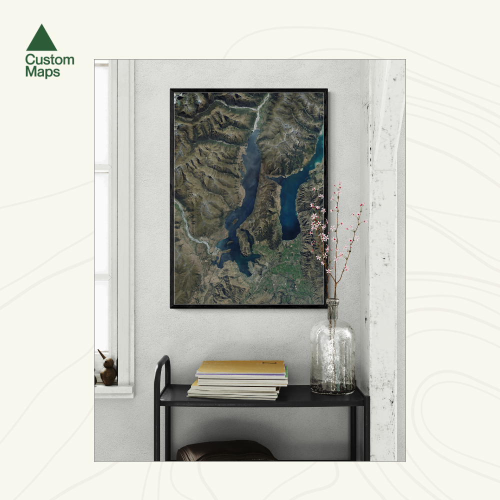
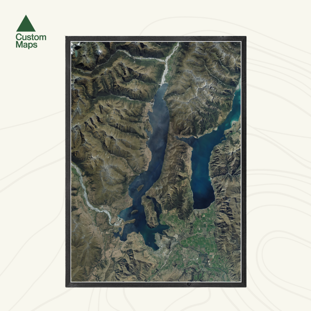
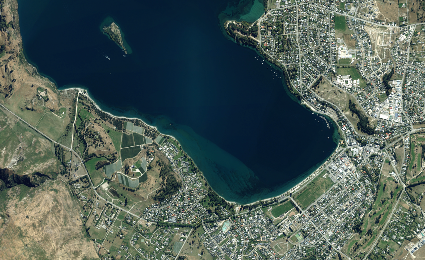
Lake Wānaka Aerial Print
Lake Wānaka Aerial Print
- Ships from NZ
- Hundreds of Happy Customers
- The Perfect Gift
Couldn't load pickup availability
A striking aerial print of Lake Wānaka, showcasing the crystal-clear waters, dramatic Southern Alps, and the towns of Wānaka and Hāwea in stunning high resolution.
Designed using vivid aerial imagery (2017–2019), this print captures the natural beauty of the region - from the braided rivers and rolling farmland to the rugged peaks of Mount Aspiring National Park. This map makes a bold statement in any home, bach, school or office.
Each map has been meticulously edited for clarity, colour balance and visual impact. Our maps are made from hundreds of aerial photos taken on different days, so subtle colour variations may appear.
Custom locations and close ups also available - please contact us.
Print Options:
1. Classic - Our original print, printed on premium photographic paper. Sold unframed so you can choose the perfect frame for your space - see our framing guide for options. Available in three sizes:
- A0 (84.1 x 118.9cm) - An A0 print gives optimal detail and resolution.
- A1 (59.4 x 84.1cm) - A more compact print.
- A2 (42.0 x 59.4cm) - Our most compact print.
2. Framed Canvas - Our premium option. Printed at A0 (84.1 × 118.9cm) on art-grade canvas and framed in a raw wood float frame (10mm wide, 45mm deep). Arrives ready to hang - no framing, no hassle. Allow up to two weeks for delivery. See full details and examples here.
Lake Wānaka Aerial Print
$165.00
Print Type