


Custom Maps
Taranaki Wall Map
Taranaki Wall Map
- Ships from NZ
- Hundreds of Happy Customers
- The Perfect Gift
Couldn't load pickup availability
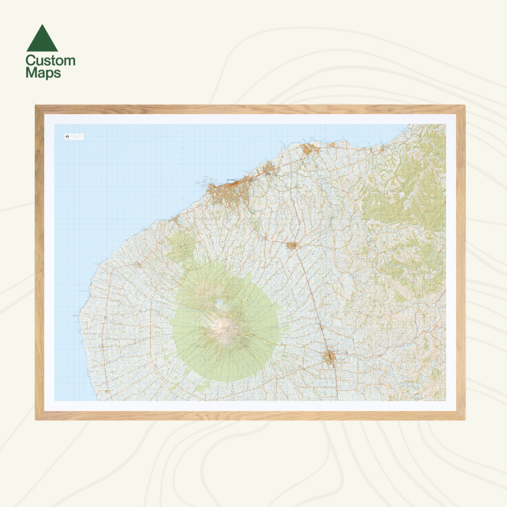
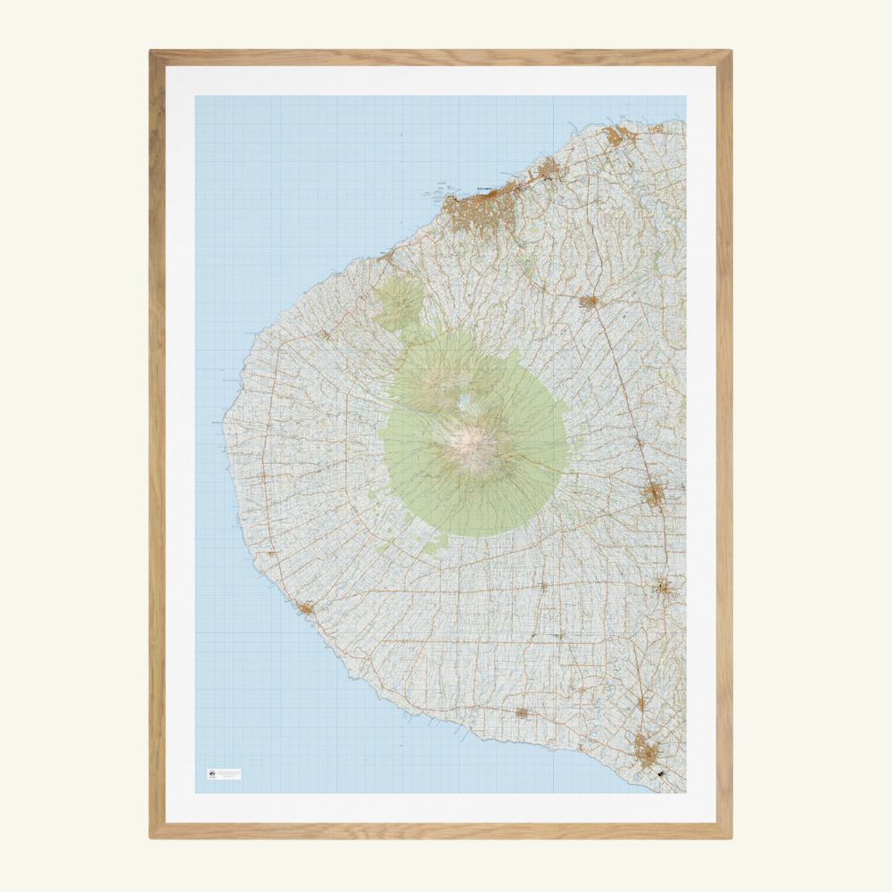
This giant topographic map of Mount Taranaki and the surrounding area makes a stunning statement piece for any room.
Professionally colour printed on high-quality, heavy-duty, water-resistant, tear-proof paper with a borderless edge.
Produced using Topo50 data, two options are available that each brilliantly showcase the area:
- Portrait: This map shows Mt Taranaki, New Plymouth & Waitara in the north, Stratford and Eltham in the east, Hawera in the south and Opunake in the west.
- Landscape: This map also shows Mt Taranaki, New Plymouth & Waitara, as well as the Taramoukou Forest and western Pouiatoa Forest
Variations are available on this map, or any other custom topo map - please enquire.
Sold unframed. Pair your map with one of our Wooden Map Frames, so it's ready to hang when it arrives, or see here for more framing information and frame options.
Size Options:
A0 (84.1 x 118.9cm) - Recommended. An A0 print gives optimal detail and resolution. This map was designed for A0 printing and A0 is our recommended print size.
A1 (59.4 x 84.1cm) - A more compact print. Some smaller text might be illegible.
Taranaki Wall Map
$180.00
Orientation
Print Size